


Exploring Kenya by road can be an unforgettable experience, whether traveling between Nairobi and Mombasa, visiting national parks or discovering scenic countryside routes. However, unreliable mobile networks, unexpected road closures and inaccurate navigation instructions can quickly complicate a journey. Depending entirely on smartphone maps is risky, particularly when traveling through remote regions with limited connectivity. Preparing reliable navigation alternatives, downloading essential maps and understanding local driving conditions can make road trips considerably easier. Dedicated GPS devices also provide practical assistance when mobile applications become unreliable.
Download Maps Before Leaving Major Cities
One of the most effective ways to avoid navigation problems is preparing your maps before leaving a major town. Mobile applications frequently depend on internet connectivity for updated directions, traffic information and location searches. Downloading offline maps covering your complete journey can provide essential guidance when mobile signals disappear. Include alternative roads, nearby fuel stations, accommodation and important landmarks in your preparation. Remember that offline maps may not reflect temporary closures or recent road changes. Check your routes using multiple reliable sources before beginning longer journeys.
Invest in a Dedicated GPS Navigation Device
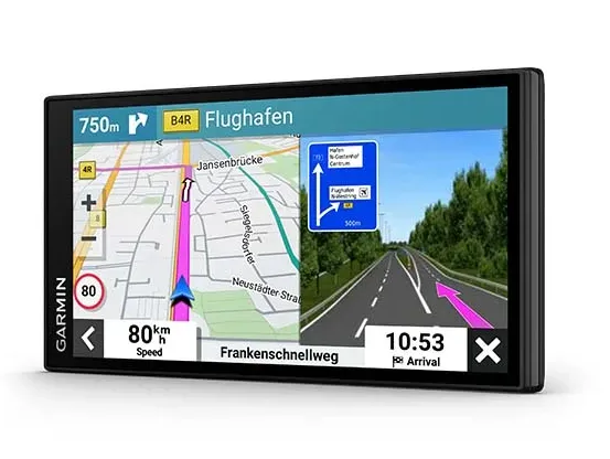
A dedicated navigation device can provide greater convenience than constantly checking a smartphone while traveling. The Garmin DriveSmart 76 features a seven-inch high-definition touchscreen, voice-assisted navigation and driver alerts designed to make vehicle journeys more manageable. Its built-in Wi-Fi also supports convenient software and map updates. However, Kenyan travelers should verify regional map compatibility and obtain suitable Kenya mapping before departure, rather than assuming the device includes local coverage. Having a dedicated navigation screen also reduces dependence on a smartphone throughout the journey.
Choose Routes Carefully When Traveling Across Kenya
Kenyan highways can present different challenges depending on the region, weather and time of travel. Routes connecting Nairobi, Nakuru, Eldoret and Mombasa may experience heavy traffic, slow-moving vehicles, roadworks and unexpected delays. Smaller connecting roads can also have potholes, limited signage and poorly maintained surfaces. Instead of automatically accepting the shortest route suggested by a navigation application, consider road quality, available services and current travel conditions. Following established highways and checking official road information can help prevent unnecessary detours and reduce exposure to avoidable driving hazards.
Keep Motorcycle Navigation Equipment Ready for Adventure
Motorcycle travelers require navigation equipment that can withstand vibration, changing weather and demanding riding conditions. The Garmin zumo XT3 is designed specifically for motorcycle navigation, featuring a glove-friendly display, rugged construction, preloaded mapping and route-planning capabilities. It also supports imported GPX, KML and KMZ routes, making it useful for riders preparing detailed journeys. Its water-resistant construction adds reassurance during unpredictable weather. Riders should still verify Kenyan map availability and download compatible mapping before exploring unfamiliar destinations.
Prepare Backup Navigation and Essential Travel Information
Even reliable GPS equipment should never become your only source of navigation information. Keep a physical road atlas, written directions and important accommodation addresses available in your vehicle. Saving emergency contacts, fuel station locations and nearby medical facilities can also prove useful when electronic equipment stops working. Carry a charging cable, vehicle power adapter and suitable power bank to maintain essential devices throughout longer journeys. Before departing, share your itinerary with someone you trust. These simple precautions provide additional reassurance when traveling through remote areas with limited connectivity.
Prioritize Road Safety Over Navigation Instructions
Navigation technology should support responsible driving rather than determine every decision on the road. Kenyan highways can contain pedestrians, livestock, motorcycles, unexpected speed bumps and vehicles traveling unpredictably. Drivers should remain alert, maintain safe following distances and avoid unnecessary night-time journeys outside urban areas. During heavy rainfall, check whether planned routes remain accessible before continuing. Never attempt to interact with navigation equipment while driving. If directions become confusing, stop somewhere safe before checking your position. Combining digital guidance with local road awareness creates a considerably safer traveling experience.
Conclusion
Successful road trips across Kenya depend on preparation, dependable navigation and sensible driving decisions. Offline maps, dedicated GPS equipment and alternative travel information can prevent smartphone connectivity problems from disrupting important journeys. Whether exploring major highways in a family vehicle or riding through scenic countryside, choosing equipment suited to the journey makes navigation easier. Always verify local map coverage, check road conditions and carry backup directions before departure. Exploring navigation solutions through garmin.com can help travelers identify suitable equipment and prepare more confidently for their next Kenyan adventure.